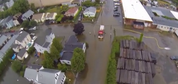
The National Weather Service in Taunton has issued a Flood Watch for all of Southern New England from Friday morning through Saturday afternoon.
* The combination of moderate to heavy rain forecast on top of snow melt and the possibility of isolated ice jams along area rivers and streams presents the threat of flooding.
* Storm total rainfall amounts 2 to 3 inches upwards of 4 inches are forecast over the entire region.
* Flooding not only will be exacerbated along area rivers and streams by potential isolated ice jams which could lead to locally fast, significantly high river rises, but also within urban centers given the likelihood of snow clogged drains that will lead to poor drainage.
PRECAUTIONARY/PREPAREDNESS ACTIONS.
A Flood Watch means there is a potential for flooding based on current forecasts.
You should monitor later forecasts and be alert for possible Flood Warnings. Those living in areas prone to flooding should be prepared to take action should flooding develop.
 New Bedford Guide Your Guide to New Bedford and South Coast, MA


