New Bedford’s Early Villages; Turning Sprawl into a City
New Bedford, the village. The two don’t seem to go together, but as hard as it is to believe, there was a time when New Bedford was a small village. The entire region had hamlets, villages and towns and New Bedford was one of many. I have personally come across approximately 15 villages that surrounded the village of New Bedford. These villages eventually sprawled into one another, and as the region progressed the particular village called New Bedford stood out and raced ahead of the others. For this reason, when the villages became one, the city that they became was dubbed New Bedford. These villages still “exist” in the sense that they are now referred to as neighborhoods. In all likelihood you have heard of these villages or neighborhoods. As a matter of fact, you may use the names on a daily basis!
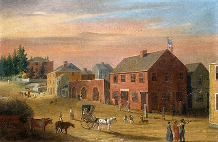
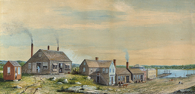
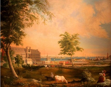
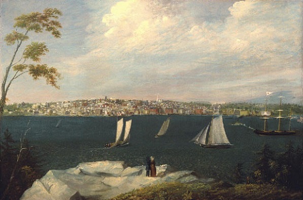
As is always the case with these historical articles, they simply can’t be “trued” without contributions from readers. The oral history and anecdotes help improve the articles. If these articles are looked at as a sort of “Wiki” with the community contributing, confirming, and adding, the articles’ accuracy can only be improved. So, please, by all means speak up. Don’t be shy! If you see an error, let us know in a comment here or e-mail us at info@newbedfordguide.com. As I mentioned above, I have come across 15 villages, but you may know of one I missed. I’d love to add her in! Lastly, since there is a serious lack of images from the 17th and early 18th century, for obvious reasons, I’ve chosen to illustrate the time using the absolutely gorgeous paintings of New Bedford resident William Allen Wall (1801-1885).
So here are the 15 villages and a little bit of information on each. Do you live in one?!
17th Century Beginnings
New Bedford harbor as many of you may already now, had Europeans putting around in it a few decades before the Pilgrims arrived. Bartholomew Gosnold we know was her on May 31, 1602. This is the fellow that gave Martha’s Vineyard and Cape Cod their names. It can’t be proven, but it is said that he made landfall somewhere around the South Terminal, northwest of Palmer’s Island in a spot called the “Smoking Rocks.”
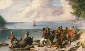
After the purchase of the Olde Dartmouth region in 1652 by Bradford and the Proprietors, people began to slowly populate the area. In the early to mid 1700s the prominent Russell family came to New Bedford village and scooped up large tracts of land along the Acushnet River and began to farm and develop commerce and trade. The Russell family traced its roots to the Duke of Bedford, and in tribute to him named the village Bedford. No “New” yet as New Bedford was simply called Bedford or Bedford Village, and it was called this as “recently” as the Revolutionary War. Indeed, many war documents make reference to the the “village of Bedford” being torched.
The Russells, Rotches, and the Duke of Bedford
By 1760 the Russells, particularly Joseph Russell, began to sell lots of his land and because of the proximity of these lots to the waterfront, it began to attract fisherman, shipbuilders and the ilk. At that point, New Bedford included Acushnet and “Fair Haven” until they broke away in 1860 and 1812 respectively. As the village began to develop, the officials decided to make a distinction between another Bedford that was already established in Massachusetts and of course, the Bedford that already existed in England. New Bedford grew into a town and was officially granted its’ charter in 1787. This is how New Bedford, got its “New.” Faster, stronger, higher.
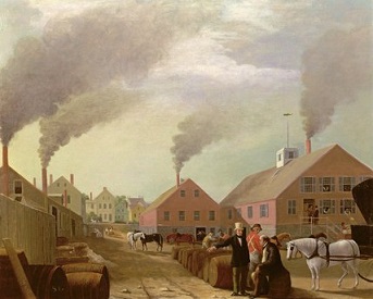
With the influx of fishermen, shipbuilders, and laborers, it was a no-brainer for Russell to begin to put some of his investment behind the growing whaling industry. When business mogul and whaling merchant William Rotch, Jr. got wind of what was going on, he came to New Bedford and began to ply his trade. Many captains soon followed. Once this happened the town began to attract merchants, banks, peddlers, and unskilled laborers. These are the biggest reasons that New Bedford grew and progressed so much faster than its surrounding villages and winning the contest to name the city they would aggregate to become.
Population Growth
By 1800 the town started to grow exponentially and by 1805 the number of dwellings had nearly doubled from 185 to 300. In 1847 it earned its city charter. By 1850 the population had again doubled and wouldn’t double again until 1890 reaching almost 35,000 people. People continued to relocate to the city until it reached its highest population, mainly due to the textile boom, in 1920 at 121,217 people. New Bedford’s population has declined slowly since then but has perked up a bit in recent years.
Here are the many villages that make up New Bedford in alphabetical order:
1. Bedford
Well. This obscure, unknown village outpaced the other villages to become New Bedford. Or so I’ve heard.
2. Belleville or Bellville
Belleville village is in the eastern part of New Bedford. Belleville Avenue runs through it. It was noted as a launching site for many of the whaling vessels, and a family called the Stetson’s were well-known shipbuilders who operated here. I’d imagine the name originated from the volumes of bells used whether to alert people of ships being launched or returning, or perhaps due to the number of Bethel’s or Church’s in the village.
3. Cannonville
Not to be confused with the Cannonville in the southern part of Mattapoisett, this Cannonville was located in the western part of New Bedford, what was or is the 2nd ward. Cannonville included Oak Grove Cemetery, Clasky Common Park, Kempton Street, Union Street, and was really at the heart of the city. Samuel Leonard & Sons ran the largest oil refinery in the nation out of Cannonville near Water Street and there is still a Leonard’s Wharf today in front of the recently built Fairfield Suites. There is still a small strip of Cannon Street left today and this was one of the villages that had a post office in the early years. Its eastern border reached the waterfront where the whaling vessels docked. There were cannons here that were used to defend the city and this is one possible way that the village got it’s name, but it’s pure conjecture.
It is possible that it is named after a surname as is the case with the Cannonville in Utah as there were a few Cannons living in New Bedford, particularly a James Cannon that was a surveyor, Henry Cannon, a boat steerer and Philip, Edward and Nathaniel Cannons that were owners of a number of whaling vessels. It was Henry Cannon that the street that still exists today was named after and is a likely candidate if this is the case. Regardless, the 1790 census turns up a Philip (perhaps the son of the above Philip) and a John Cannon who are also likely candidates.
4. Clark’s Point
Clark’s Point Village is the specific spot where the southern coast between Clark’s Cove and the entrance to the New Bedford Harbor is and the homesteads that surrounded it. There was a fixed white light at this point that was a lantern about 70 feet above sea level and said to be visible upwards of 13 miles. Clark’s Point’s first lighthouse was erected in 1797 by a small group of merchants. It is likely that one of the merchants – a Clark- named the point. Dear reader, if you know better, please let us know.
5. Clifford
1790 turns up no one with the surname Clifford. The first notable Clifford to show up in New Bedford’s history is a John Henry Clifford born in 1809, shortly after New Bedford became a town. Mr. Clifford practiced law in New Bedford from 1827 until he became president of the Boston and Providence Railroad in 1867. He also became the Attorney General and 21st Governor of the Commonwealth of Massachusetts before passing away in 1867. He is definitely a candidate for the dubbing of Clifford Village considering there were no Cliffords in New Bedford before him. There is still a Clifford Street today. However, the only problem with this theory is that New Bedford was no longer a village or town in 1847 when it officially became a city. This is also one of the first places to have a post office well before 1890. In Rev. Elias Nason’s 1890 book “A Gazetteer of the State of Massachusetts” he mentions Clifford as a village then.
6. Germantown
Germantown?! Hard to believe but there was a large ethnic German presence in Bedford Village. To this day they are the largest ethnic group in America with 50 million people being able to trace their heritage back to Deutschland. That is a third of the entire German population outside of Germany. Massachusetts is ranked 30th with 400,000 today. The first wave of Germans started in the 1670s and they settled in nearby New York and Pennsylvania. In 1742 a thousand Germans came to Broad Bay, Massachusetts to do something they were well-known for: farming. Some local Amerindians weren’t too happy about this rather large community so they burned all their homes and farms down. They fled east and decided to no longer farm and and most took up fishing.
In the 19th century, there was massive immigration of some 8 million Germans to the New World looking for economic opportunities. New Bedford of the 19th century had plenty of opportunity and like many ethnic groups they banded together in small communities. One of those communities was dubbed Germantown and it was in the North End where today an estimated 5,000 people of German heritage still live. The most notable German in Bedford Village was artist Albert Bierstadt whose family came in 1831. Relevant to this article is his absolutely gorgeous “Gosnold At Cuttyhunk.” In the 1860s New Bedford had a Rheinberger Club or Sängerbund which was a German singing club as well as some German-only clubs like the Independent Order of the Red Men on North Second Street, and the Order of the Iron Hall on Purchase Street.
7. Howland Mill
Howland Mill Village was named so circa 1888 when Howland Mill Corporation erected factory housing for its workers in the southwestern part of the city. This wasn’t the first time a textile company had built factory housing, but it was the last. Unlike many of the other villages this village was not spurred on by the whaling industry. This “village” is hemmed in by Rockdale Avenue, Bolton Street, Hemlock Street, and Jenkins Street.
8. Jesseville
Jesseville is another village mentioned as presently existing in Rev. Elias Nason’s 1890 book “A Gazetteer of the State of Massachusetts.” This village is the toughest one out of the group to find anything about. In the 1790 census, the only Jesse found is Jesse Keen(e). There are two other Keens mentioned in that census, her father Ebenezer Keen Sr, who was a contemporary of William Tallman and an ex-military man, and her brother Ebenezer Keen jr. Is it likely that this ex-soldier and Tallman contemporary was prominent enough to get a community to accept his bright idea of naming it after his daughter? I really couldn’t answer that.
9. Kenersonville or Kennersonville
A Google search on Kennersonville doesn’t even turn up a full two pages of results for a whopping total of 16. I did however find, a few Kenersons who lived in New Bedford, alternate spellings of Kinnison and Kennison. A Kenerson family moved to New Bedford sometime in the 1850s from Maine. Samuel Kenerson’s wife was Caroline Taber, a name that needs no explanation. They had two children, a daughter Lena and a son Benjamin. Benjamin Kenerson was a road-master for N.B. & T Railroad and lived North of Rodman’s Farm, which is said to be near “…a railroad crossing north to Acushnet Village.” and at “…the line of County Road.” He had a son George, who was a N.B. Fireman. This little clan named their little spot Kenersonville.
10. Plainville
Old Plainville Road cuts right through today’s airport in the northwestern part of the city near Dartmouth. This village extended towards Hathaway Road to the south in which today is virtually all land. This village got its name, like many of the Plainvilles in the region, because…well there is a plain there.
11. Rockdale or Rock Dale
This village was in the western part of the city just south of Plainville Village. By definition, a “dale” is a valley, vale or glen. There are a number of Rockdale or Rockdales in the country and they all have one thing in common. A rather large rock. Where this rock is located at, is anyone’s guess. Is it there today? Do you know of a large rock somewhere along Rockdale Avenue?
12. Shawmut
The term Shawmut is derived from the Algonquian word Mashauwomuk of unknown meaning. All that is known is that it refers to canoe and water. We have a Shawmut Avenue, Diner and Apartments. We know what the word roughly means. What we aren’t 100% of is where exactly Shawmut Village was. The only water that present-day Shawmut Avenue pass through or over is Turner Pond near the airport. Perhaps it was near here where the village sat.
13. Turner Mills
Turner Pond is the name where Turner Mills was. Who was this early Turner and what kind of mill did he have?
14. Weld Street Station
The Weld Family is a family of Boston Brahmins whose records, genealogy and accomplishments are well kept and go back to the 17th century in the New World and much further in England. However, there is no real history of a Weld presence in New Bedford. The village may have been named for one of many Welds who took part in a variety of wars, including the King Phillip War, Civil War, Pequot War, and Revolutionary War. Some Welds delved into sailing vessels, others in farming.
15. Winterville
This was another village with next nothing about it. The only name that pops up is a gambling man by the name of Ed Winter and a short Winter Street which is the Rural Cemetery. This street has approximately 6 houses now.
Population Statistics through the Years:
1795 – 1,000 people and 454 houses.
1797 – 3,313 people.
1801 – 5,600 people with 185 dwellings.
1805 – Almost double the dwellings to 300.
1830 – 7,695 inhabitants. 7,592 also stated.
1840 – 12,087 people.
1847 – 16,000 people.
1850 – National census states: 16,443 people.
1855 – State Census: 20,389 people.
1865 – State Census: 20,853 people.
1875 – State Census: 25,895 people.
1890 – 33,393 inhabitants, 5,598 dwellings, and 67 farms.
1900 – 40,733 inhabitants.
1905 – State census: 74,362 inhabitants.
1910 – 96,652 inhabitants.
1916 – 118,158 people.
1920 – 121,217 people, 98 mill buildings.
2000 – 93,768 people, 38,178 households.
2005 – Census states: 93,102 people.
2010 – 95,072 inhabitants.